Travelogue

October 31, 2015

Filed under: Kyushu — admin @ 2:55 PM

November 17th – 22nd Solo Iron Butt Saddle Sore 1600K and Kyushu Ride

Day 1 -  Tokyo Nerima Gas Station – Nerima IC (Kanetsu Expressway) – Fujioka (Joshin Expressway) – Chikuma (Joshinestu Expressway) – Joetsu (Hoikuriku Expressway) – Maihara (Meishin Expressway) – Kusatsu (Chugoku Expressway) – Shimonoseki (Kyushu Expressway) – Ebino (Miyazaki Expressway) – Miyazaki – Total Distance 1,673 kms, Total Time 17 hours 55 minutes

Given Kyushu is some 1300 kms, I decided to take up the Iron Butt challenge on the way. Going straight to Kyushu wouldn’t give me the required distance so I considered two options – (i) start from Shizuoka, make a U turn at Tomei and then head all the way to Miyazaki (ii) start from Tokyo, head to Nagano on Kanetsu and then take Hokuriku expressway along the west coast of Japan. I was a bit worried about the temperature crossing through Nagano, but ended up choosing the later route as I have ridden on Tomei expressway countless times before.

Plan was to leave Tokyo on late Saturday night, kick off the challenge as close to expressway as possible and then hit the expressway right after midnight to take advantage of 12:00-4:00 toll discount. So I chose the start point at Gas station right before the Nerima IC and end point at Gas station in Miyazaki. Also, I preparation I rode out to Gotemba to burn in the band new tyres that were replaced right after the trip to Miyagi ken.

I was watching the weather all along and while it was supposed to be clear, it suddenly started raining from Thursday night and continued all along on Friday. This really got me thinking if I should cancel the Iron Butt challenge and head straight to Kyushu or push the trip back by one day, especially given weather looked back in Nagano direction but was reasonably clear down South. In the end I just decided to give it a go.

Dressed up in layers of warm and safe full heated gear, protective outfit and rain suit, I arrived Gas station at Nerima around 23:45 on Friday night. It was still raining but not as bad. Given my tyres were still some 200 kms old, I made a mental note to be extra cautious for few 100 kms.

12107882_10153708429104283_7707735801580048060_n

Filled up at 23:55 and headed straight on to Kanetsu. Following the mantra of “consistency, not speed”, I was able to maintain pretty decent time throughout the ride. In addition to the Garmin Zumo, my Garmin Oregon 650’s dashboard came in pretty handy with all sort of stats including overall average speed.

Things went well for first few hours and then the disaster stuck. At one of the stops, after checking my emails, I had perhaps not secured my iPhone well in the top case of my tank bag. It was connected to power outlet via a charging cable and at some point the vibration and bumps caused it to slide out of the flip case. I realised this almost immediately and stopped, however it was still dark and there was no way I was going to find it. I was also not inclined to venture on the expressway. There was a emergency phone booth some 100 meters backwards from where I was, so I just went there bit given all instructions were in Japanese I was not sure what to do. I was brightening up slightly so I just decided to wait there in the hope that one of the rescue vehicles will just happen to pass by. I was loosing time and was in double mind – shall I call the expressway from next stop and continue or wait to recover my phone at the risk of loosing the IB challenge. No rescue or police vehicle arrived but it lighted up sufficiently in next 15 mins for me to be able to see my Phone’s carcass few meters from where I was. Recovering it was a strange sense of relief – at least I could not continue the Iron butt challenge without being worried about having given up on my iPhone….

The first picture taken by the new iPhone later at Kitamura camera shop….

IP_0002

Called wife from the next stop and informed her of the incident. First she was terrified thinking I had fallen but took the message pretty well after understanding and promised to call softbank to check my options while I could continue with the IB challenge. With this worry over, I continued the ride. Pretty disciplined and consistent ride and I was approaching finish point well within the targeted time. Knowing shops will close early on in Miyazaki, I stopped at the Hirokawa SA and called my wife, who by this time had spoken with soft bank, explained my situation and spotted a soft bank shop near my destination. Given it was to close by 6:00 PM, I first headed to the shop, which in turn asked me to go to Kitamura camera for a paid exchange instead of a new phone. This consumed some time so I took the first witness signature from Kitamura camera staff. Ended up with a dent of 87,000 yen for the phone and protective case. Nonetheless I was relieved that I had a phone. There was a Gas station right next to the Kitamura camera so I decided to use that as my Finish point. Here I refilled the tank at Shin Beppu gas station, where the gas station staff signed the witness form.

Headed to the hotel and they were glad to sign the third witness form although this was completely unnecessary.

IP_0006

The Saddle sore 1600K track

Screen Shot wout time 2015-10-25 at 3.32.17 AM

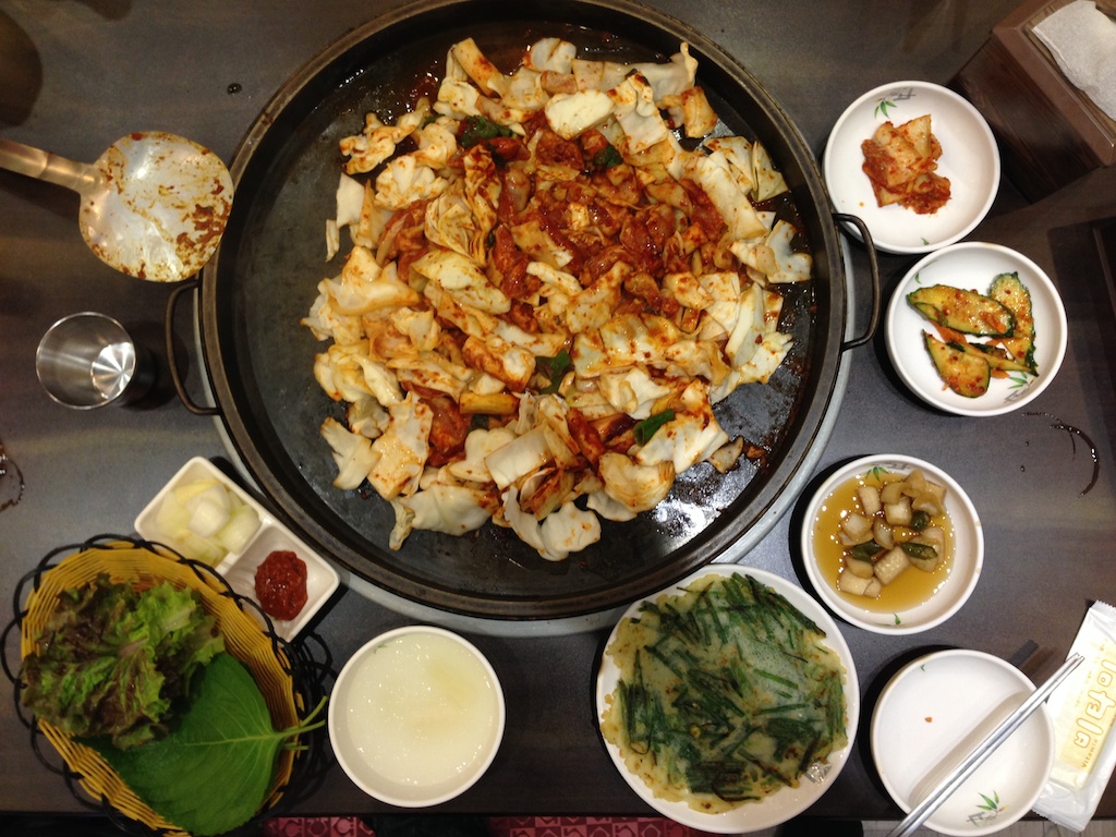
Once checked in, I took a quick shower and headed out for dinner. What better then try Miyazaki’s speciality chicken!

IP_0012

Off to bed, I was surprised how comfortable Super Tenere is, after such a long ride there was no body ache etc. Got my thinking it is entirely possible to try out Iron Butt Bum Burner challenge some day.

The other thing that came to mind was that the last time used a pay phone was more then a decade ago, and that my children don’t even what a pay phone is. Made a mental note to take them to ay phone booth once I was back home.

Day 2 – Miyazaki – Toi Misaki – Sata Misaki – Sakura Jima – Total Distance 260 kms

Screen Shot 2015-10-31 at 11.57.35 AM

Todays plan was to ride in Osumi peninsula in Kagoshima  and reach as close as possible to Satsuma peninsula. So following a lazy start I took the coastal route 220 along Pacific ocean towards Cape Toi Misaki. Quite windy day and the waves for excellent for lot of surfers to be out there!

M3_0031

I guess this advertisement will turn off a lot of second (or more) timers ;)

M3_0040

I had never been to Toi Misaki and was quite excited to bag the same, however soon hit the road block as the road was closed. One thing I have learned in years is that if the Japanese say a road is closed, it IS closed. So instead of trying to find a way to circumvent the barrier, I headed back to take detour

Oh yes, Toi Misaki bagged!

M3_0051

Views from Toi Misaki

IP_0018

The small tripod I carry came in handy here, although the horizon seems sinking on the left

M3_0058

A small route leading to Sago Palm habitat in the same peninsula and a Jinja gate there

M3_0068

There are supposed to be horses here, semi-tame though compared to the wild one’s at Tsugaru hanto in Tohoku area. Did find them although quite far from the road

M3_0071

I then continued towards Sata Misaki on 220. Quite beautiful rice fields and scenery along the way

IP_0022

The curvy road to Sata Misaki.

M3_0141

The last time I was here was here was in 2008 and unlike then, the road to Sata Misaki now terminates some good 200 meters earlier and one has to walk the rest of the way. There are seating benches and vending machines at the start point and I am sure its a better of time before there will be a ticket booth to visit the Misaki

The walk way to Misaki

M3_0088

And finally the Misaki itself, southernmost point of Kyushu!

M3_0118

IP_0042

By this time it was late in afternoon and it is clear I would have to make a stop at Sakurajima. Called and booked Sakurajima Ryokan. Distant view of Mount Kaimondake from route 269

IP_0045

And finally Sakurajima in the dusk. It looked majestic and the camera just simply do enough justice.

M3_0176

After a little bit of ride on the island, I checked in to Sakurajima hotel. Its an old building but quite pleasant surprise – for 5,500 JPY per night stay and 7,200 JPY with dinner and breakfast included along with a natural onsen, it was a pretty good find!

IP_0064

IP_0066

After a dinner sandwiched between two onsen soaks and a massajiki (massage machine) session, I headed to bed

Day 3 – Sakurajima – Cape Nagasakibana – Cape Nomamisaki – Nagashima – Ushibuka Total distance 293 kms

Screen Shot 2015-10-31 at 12.02.57 PM

Woke up quite early and headed to the rotemburo as I wanted to witness the sunrise while listening to the waves in calm. Setup the tripod and camera to take a picture of myself in the serene environment but by the time I was ready, another old man decided to make it to the rotemburo. Man! was I disappointed ??!! But sometimes things play out in your favour ;) The Ojisan first got surprised by seeing a naked foreigner, and then froze and finally promptly exited being a camera on tripod pointing to the Rotemburo with the live LCD on ;) Must be wondering whats the point in filming alone ;)

M3_0200

Checking out I decided to ride along the island and take a good view of the volcano. I was not disappointed. Views of Sakurajima

M3_0215

The famous Jinja gate buried under the lava

M3_0229

I was planning to take the road to Kagoshima but the Ryokan staff told me that taking a ferry from Sakurajima port to Kagoshima port will be faster. Indeed the ferry runs every 30 mins and costs less than 1000 JPY including bike (actually you pay for the bike and you are free). Boarded the same.

M3_0243

Once on the Kagoshima side, I headed towards Cape Nagasakibana. By this time it was starting to get a bit hot. And to make matters worse, I made mistake on taking the route twice to Ibusuki skyline, clearly the sign that I was more tired than I realised. Here I took a 45 mins break feasting on food and drinks from a combini. Recharged, I was on Ibusuki skyline in no times. It was awesome to ride on it after 7 years, pure riding pleasure!

M3_0259

Sakurajima is MASSIVE. Distant view from Ibusuki skyline

M3_0270

A distant view of Mount Kaimondake and Lake Ikeda. Just like last time, it was hazy making it very difficult to take a clear shot of Mount Kaimondake, known as Mount Fuji of Kyushu due to its conical near conical shape.

M3_0282

Nice, very nice!

M3_0279

Lake Ikeda

IP_0085

And the Cape Nagasakibana

M3_0303

From here, I headed to Cape Noma Misaki. Rode nonstop for a a long time (including twisties) until the reached at the platform on cliff overseeing Okiakimeijima Island. The cliff drops vertically for more then 150 feet (me thinks) from the platform. After couple of hours non-stop ride, it was tremendously refreshing to take a wild leak standing at the edge of the cliff. What a relief! fortunately there was almost no wind!

IP_0090

The edge of that long stretch is Cape Nomamisaki!

M3_0324

The last few hundred meters to the Cape is quite scary, the road turns in to cemented path about a meter wide, winds sharply and ascends quite quickly, none of which are a good sign when you are on a 260+ kg bike loaded with you and your gear. Nonetheless I made it to the top and was quite pleasantly surprised to see another motorcycle parked there. The feeling didn’t last long when the rider decided to depart without responding to a hello. A second rider arrived on a 400 cc Honda soon and while he respond to hello, didn’t leave much of comforting impression by walking around and talking to (and seemingly disagreeing with!) himself.

Nonetheless I clicked a few pictures, after all I had bagged another Misaki, and then headed down.

IP_0097

M3_0331

From here I headed towards Nakashima Island. Beautiful views along the way

From here I took a ferry to Ushibuka and following a brilliant sunset over the sea, checked in to a Business hotel.

M3_0347

IP_0112

I was quite tired but wanted to take a quick dinner and make plans for next day ride while eating. Took a quick shower and asked the owner for recommendation. Strangely enough, he recommend me to walk down few blocks while there was a place called Heart (Hatto in Japanese) to eat right next door. Nonetheless I headed the recommended place.

Quite small place in countryside, I was a bit hesitant when I first saw it but given I had no options, knocked and went inside. The hostesses and a few guests recovered well from a millisecond of shock and immediately invited me in, and it was immediately clear to me that this wasn’t going to be a ‘quick dinner’.

Lots of fun at the place! If you are ever in the area, I recommend you go visit this place! Saira in the top picture

IP_0114

IP_0115

IP_0119IP_0120

I don’t recall at what time, but definitely much later then what I had originally intended to, I headed back to the hotel with a handful of notes and invitations on where I should visit and who could help me the following day in Amakusa. I had already lost the count of hugs I had. Speaking Japanese definitely helps!

It was not over yet though. As I was trying to pick up the key from reception, a Japanese guy (Karashima San) just approached me, said hello and invited out. Well, no point in being rude. So he called a Taxi to place called Deep River (another place I highly recommend if you happen to be in the area) and we headed out.

Among other things, there was making new friends and singing at karaoke, Santana and Aerosmith were in town!!

IP_0122

IP_0129IP_0123IP_0131

Wayyyy past my original target I headed back hotel. By this time I had truly lost the hugs count and couldn’t figure how many perfumes I had on me. Oh well, it was a great evening and I made some new friends!

Day 4 – Ushibuka – Amakusa – Shimabara – Unzen – Fukue – Total distance 274 kms

Screen Shot 2015-10-31 at 12.11.11 PM

Early AM start towards Amakusa. I managed to find the church that everybody was talking about last night! Pretty quite AM in Sakitsu

M3_0375

Pretty quite morning in Sakitsu

M3_0378

After riding a bit, I took the Ferry from Shimoshima to Kuchinotsu port in Shimabara, Nagasaki.

M3_0381

Once on the Nagasaki Island, I decided to circle around the Shimabara Peninsula

Japanese Popeye ? :)

M3_0385

Someones personal collection with Mount Unzendake in the background

M3_0388

And a Jinja

M3_0397

The east cost route is pretty boring, however route 57 cutting through the Unzen Amakusa National park is s quite twisty

The hot springs in Unzen Jigoku. The whole place is buzzing with geo-thermal activity and you can see the pipes taking natural hot spring water to Onsen’s in the back drop.

M3_0402

Lake Suwano Ike

IP_0147

Having traversed the peninsula, I then took the scenic west coast route 251 to up north. Quite beautiful sea all along, the camera doesn’t do justice to what was actually there…

IP_0152

IP_0154

It was quite a beautiful day to ride actually. Finally I took the ferry to Fukue Island. To Goto Island finally!

IP_0195

IP_0202

Bunch of school kids going back home. Wonder what it is like to commute to school via Ferry everyday!

M3_0419

Reached Fukue Island and all was not good. The hotel that I had booked few hours back was just a few hundred meters away from the port but was in completely dark alley and looked deserted.

IP_0219

Went inside and called out loud but no answer. Dailed the number again and few mins later hotel staff came running and asked to come to a different hotel building, the main one. This one was in a better location. Checked in and a dinner and shower later went to bed.

Day 5 – Fukue – Cape Osezaki – Naru – Wakamatsu – Nakadori Shima – Cape Tsuwazaki – Aokata Total distance 213 kms

Screen Shot 2015-10-31 at 12.13.01 PM

Today’s plan was to hope and circle around Goto Islands. As it happens, the frequency of Ferry between these Islands is not very high and on the particular day was limited to just one as one of the ship was under maintenance. Route 384 along the coast is quite scenic and twisty. The first stop was Cape Osezaki on the western tip of the Island. Its makes for a spectacular view from the observation platform.

M3_0512

After this, I continued up north on route 384 through Saikai National park. Beautiful day to ride and quite nice scenery.

IP_0239

The route soon turned twistier and I picked up speed. As I was speeding through the curves, I noticed something not usual in the middle of the road and somehow managed to prevent running over it. It was this dude, quite curious at the camera lens towering over it, but refusing to move still. It brought back memory of my crushed iPhone. If only somebody else was as vigilant as me ….!

M3_0524

Fukui has some beautiful beaches like Tontomari and Takahama beach below.

M3_0535

IP_0240

After wrapping off Fukue, I just made in time for the Ferry that was to take me Wakamtsu via Naru Island. I didn’t stop at Naru as it looked too small to do any meaningful ride. Instead I dropped off at Wakatamstu Island. It consists of a number of small Islets connected by bridge and the views are extremely beautiful. Again, the camera does not do justice to what I saw.

IP_0246

From Wakamatsu, I crossed over to Nakadorishima and headed over up north to Cape Tsuwazaki. While I could make it to the Northern tip of the Island easily, the lighthouse itself is hidden from the road and quite difficult to find, at least for foreigners as there are no clear sign boards and the small wooden direction boards had everything in Japanese.

The light house at Cape Tsuwazaki

IP_0267

After this I checked in to a hotel, light dinner and off to bed

Day 6 – Aokata – Tomozumi Port – Hirashima – Kakinourajima – Oshima – Tokyo – Total distance 1,182 kms

Screen Shot 2015-10-31 at 2.32.51 PM

Given the only Ferry from the standard service would come only in the evening, i had decided to take a local ferry service from Tomosumi port. Arriving at the port, I almost thought my Navi as taken to me some wrong place as there was nothing there to suggest a Ferry service is being run from there. Scared that I may get stuck on the Island for while day with nothing much to day, I hurried back to town nearby. There I was told that I had gone to the right place earlier and should just go back there and wait. Sure enough, he was right. 15 mins prior to the Ferry arrival, an old woman came via car and just started selling the tickets.

Rock face at the port in morning light

M3_0590

The Ferry left on time and was the smallest one I have ridden with a vehicle so far. By the time I got out, the S10 was showered by sea water multiple times.

IP_0314

Hirashima – i didn’t stop here.

M3_0608

Quite interesting poster in the first class section of the ferry :) Guess they have seen some rowdy customers ….

IP_0334

Originally I was to due to land at Sasebo port, however I realised that the small Islands of KakiKakunouranoura and Oshima were connected to Nagasaki via bridges. So I decided to get down at Kakinoura Island almost when the Ferry was ready to pull out. Ship staff was OK with this but panicked because they didn’t know how to refund me the fare from here till Sasebo ;) Waving it off I got down.

View from Kakinoura

M3_0624

And the Nakata bridge to Oshima.

M3_0637

After landing at Nagasaki I decided to head towards Mount Aso San. However I had been there already, plus being away from the family for 6 days was taking its toll as well. Given Aso and surrounding visit was still fresh in my mind, I decided to head over to Tokyo. Pretty uneventful ride from there to back home in Tokyo.

GPS stats

39

GPS track

Screen Shot 2015-10-31 at 12.14.55 PM

And the S10 at Ibusuki skyline! This spot hasn’t changed in years too!

M3_0278

September 26, 2015

20150921 Miyagi and Iwate Solo Ride

Filed under: Iwate — admin @ 3:29 AM

Day 1 – September 21st – Tokyo – Ishinomaki – Miyako – 791 kms

With only two days in hand, I decided to maximize available riding time in Miyagi and Iwate by covering as much highway distance as possible during the night on both sides.

Typical early morning start

IMG_8685

Weather was good, but the temperature dropped to about 11 degrees on the way, felt much more lower on the bike but the warm and safe heated gear kept me comfortable. The S10 at one of the rest stops.

IMG_8687

Exiting highway I tool route 2 towards Cape Kurosaki in Ishinomaki. Noticed these as soon as I got off the highway. Later on witnessed more of these along the entire east coast. Japan is definitely attempting to fortify its east coast against the ocean. Don’t think there will be any open beach left on east coast in future.

IMG_5730

Typical Japanese efficiency, even these were numbered and stacked accordingly….

IMG_5731

Pretty uneventful ride up to Ishinomaki and a beautiful sunrise at Cape Kurosaki

IMG_8697

Thereafter I continued up north along the coast.

IMG_5754

IMG_5762

IMG_5768

Another Cape – Kamiwarimisaki. No lighthouse etc but it had beautiful views

IMG_8699

IMG_8703

Further up north a small temple at Cape Hirotamisaki

IMG_5802

Some nice countryside along route 45

IMG_5810

Route 250 towards Cape Shikotosuzaki turned out to be pretty lonely one and a dumping ground for many!

IMG_5839

IMG_5823

IMG_5836

Route  250 slowed me down considerably as the road condition turned progressively worse. Lots of gravel, water streams (amazed at how much water was flowing down) and wet muddy leaves from the rain day before forced slow speeds. Route 249 around Mount Itagiyama was no different. Found a lot of these everywhere along the best coast, no idea what these were doing high on the mountains though

IMG_5852

Eventually the road condition on 249 turned so bad that I had to turn back

IMG_5854

I then continued on route 45 towards Miyako. A local Matsuri in progress

IMG_5858

Sea view from Cape Myjinzaki route 41

IMG_5866

Finally a beautiful sunset in Miyako

IMG_5876

Checked in to a Ryokan. Sushi dinner and onset later, I hit the bed

IMG_8715

Day 2 – September 22nd, Miyako – Nakano – Kazuno – Hachimantai – Semboku – Tokyo – 902 kms

Today was going to be the day of yamamichis/mountain roads, Route 45 from Miyako to Nakano was nice, much more open and curvy compared to down south.

Again massive construction everywhere, whole mountains getting wiped out

IMG_5882

Cutting inland an old wooden bridge on route 102, still being used to access the fields on the other side of the river…

IMG_5891

And the crystal clear river water!

IMG_5901

Route 455 is an absolute pleasure to ride, plus the weather was brilliant!

IMG_5915

IMG_5916

Harvest and a family at work

IMG_5942

IMG_5944

Views from Gondo dam

IMG_5946

IMG_5954

Lake Gondoko

IMG_5967

From here I cut up North to head to Kazuno as i wanted to ride on route 341.

Mount Iwate from route 282

IMG_5974

From Kazuno I took route 341 down south. It just pure pleasure to ride and I didn’t stop until I cut over to route 23 to head to Mount Hachimantai top

Sulpher springs

IMG_5979

IMG_6019

Absolutely gorgeous day and roads to ride!!

IMG_6012

View from top of Mount Hachimantai

IMG_8772

Lake Onuma, its stunning, this picture doesn’t do justice to its serene beauty!

IMG_5981

Back on 341 I headed down south.

IMG_6023

Lake Hosenko

IMG_6030

Beautiful fields, they were just glowing in approaching dusk. Again, the picture dosent do justice to the scenary

IMG_6034

Finally it was time to hit the expressway back home.

On the way back I decided to take Joban expressway as I had never ridden on it before. Turned out to be a bit disappointing as it was just two lane for a large part.

Saw radiation monitors all along Fukushima. This one was about the highest. Just by chance I had stopped to take this picture at a point where Joban expressway quite close to the infamous Fukushima Daiichi Nuclear plant. What more – given the abandoned Futaba township the area wa so dark that I could see the lighting at the plant in distance.

IMG_8782

The red star is where I took the picture, the area with the tsunami protection on the right bottom is where the stricken Nuclear plan it.

Screen Shot 2015-09-26 at 3.19.14 AM

Pretty uneventful ride to home after this.

GPS track. Day 1 – Red, day 2 – Blue/Gren

Screen Shot 2015-09-25 at 7.45.00 PM

Trip stats

220

230

The S10 at Lake Onuma!

IMG_5987

May 23, 2015

20141118 Shimane and Matsue trip

Filed under: Shimane Matsue — admin @ 1:42 PM

2014 Nivember 18th – 22nd Shimane and Matsue Solo Ride

Day 1 – Tokyo – Shimonoseki – Nagato

Took a 1:30 AM start from Tokyo as I wanted to enjoy the Chugoku expressway in the daylight. After 7 years of abuse, my Zumo 550 mount was starting to fall in to pieces. Having lost the locking latch, I had to put some rubber bands in place to ensure the unit won’t just drop out. I have changed the mount since then…

IMG_5382

Pretty uneventful ride all the way up to Shimonoseki with some good weather on the way.

IMG_5383

From Shimonoseki, I took the coastel route towards Shimane. Here the weather was not so great and rain looked imminent.

IMG_5390

File0429

Finally it started raining. I waited for some time for the weather to clear as, as it was still early in the day and I could have ridden more. But eventually I gave up and checked in a Ryokan hotel which had a nice roof onsen. Countryside view from the 7th floor hotel room.

IMG_5394

Day 2 – Nagato – Yuyu Island – Omi Island – Hagi – Masuda – Hamada

Woke up early in the morning as today I wanted to reach and ride in Shimane. The morning sky after the overnight rain was brilliant!

File0443

And a massive rainbow in perfect full arch was out!. The 24mm lens on my EOS M was not wide enough to capture it in entirety, which is a shame…

IMG_4508

File0454

IMG_4516

It rained on and off a bit in the morning but wasn’t as bad as yesterday. Continuing along the coastal route soon I reached the beautiful bridge to Tsunoshima.

IMG_4523

Crossing over to Tsunoshima, I went to Cape Yumegasaki which also has a small park (Tsunoshimatodai park) near the light house. One more Cape, lighthouse ticked!

IMG_4530

On the way back, I stopped in the middle of the bridge to take this photo. A small Island with its lighthouse parallel to the bridge and almost midpoint between the mainland and Tsunoshima.

File0484

The weather open up a bit after this. Shame I didn’t had such good light when taking pic of the bridge to Tsunoshima…

IMG_4549

Continuing along the route in to Kawajiri – Kawashiri Mistaki – one more ticked!

IMG_5420

IMG_5417

And then a quick stroll through Yuyu Island

IMG_5422

Next Omi Island, some very good scenery here despite the overcast day!

IMG_4560

A Jinja gate in the middle of water, so typical of Japan!

IMG_4565

Continuing towards Hagi

File0513

IMG_4574

Next Pond in Hagi near Shiukayama Shrine

IMG_4581

Some clicks in Abu. This reminded of the setup I saw in South Korea, exactly same!

IMG_4603

Pan cakes ?

IMG_5429

A park of some sorts…

IMG_4626

Finally after some more riding, I called it a day. Checked in to hotel in Hamada and found a nice little setup for dinner nearby.

IMG_5434

Day 3 – Hamada – Kitahiroshia – Oonan – Matsue (Shinji-Ko and Hinamisaki)

Took at detour from coastel routes this morning and went inland on route 186. Turned out to be quite cold for this time of the year…!

IMG_5437

Lake Sensui-Ko.

IMG_4640

File0587

File0591

Rusty winter colors which my camera couldn’t capture well…

IMG_4653

IMG_4665

IMG_4678

From Kita-Hiroshima, Took the turn back North towards Matsue on route 433. Nice scenery along this one too.

File0637

IMG_4683

IMG_4698

Cutting throuh Onnan on route 261, a picture perfect country house!

IMG_4685

Some tiny roads through Misato..

File0648

Finally Hikawa River.

File0656

I then made a loop around Lake Shinji Ko. By this time, Sun was starting to come down… Some pics of the Lake.

Realizing I could perhaps reach for a beautiful sunset from Cape Hinomisaki, I then rushed towards Izumo.

File0663

File0669

File0676

IMG_4719

The sun was coming down after though. Almost down at Inasanohama beach, some 10 kms from Hinomisaki

IMG_4744

IMG_4759

Finally arrived at Hinomisaki. The S10 with the light house.

File0712

Checked in at Hirata Maple hotel after this and called it a day.

Day 4 – Izumo – Jijozaki – Esashi Island – Daikon Island – Tokyo

Plan was to go to Cape Jijozaki and then to Tokyo on this day.

Brilliant sunrise over Lake ShinjiKo this morning as I rode along the Lake on route 431.

File0723

Some more pics en route to Cape Jizozaki, including a shrine by a friends name ;)

IMG_4788

IMG_5457

IMG_4790

Finally the Cape itself.

IMG_5469

IMG_5463

File0736

Clicked a selfie here, poor lighting but proof that I ticked off another light-house !

IMG_4833

Headed to the E Island next (Esashi) and Daikon Island next. Pics on the way

IMG_4840

IMG_4843

Some beautiful views of of Lake Nakaumi from Esashi and Daikon Island

File0787

File0798

After circling Daikon Jima, I then headed back home. Quite uneven full ride back home.

S10 at bridge to Tsunoshima

IMG_4527 (1)

GPS stats

154

Screen Shot 2015-05-23 at 1.38.25 PM

September 15, 2014

September 6th-13th – South Korea Solo Ride

Filed under: South Korea — admin @ 9:43 AM

Day 1 – Septmber 6th – Tokyo to Shimonoseki. Total distance – 1021 kms

Purpose of the trip - explore the supposedly awesome Korean roads, Korean countryside and enjoy Korean local food. No big cities, fancy hotels or restaurants!

Screen Shot 2014-09-18 at 10.21.40 PM

I left at around 11 PM on September 6th  as I had to reach Shimonoseki port by 3:00PM latest the following day.

I had been checking Japan and South Korea weather every day since I had booked the ferry to Korea. Suddenly tenki.jp started saying it will rain on Saturday night between Tokyo and Osaka. This bothered me first but then not much. Every awesome ride I had always had rain god pouring on me at the start so I took this as a good sign! It indeed rained a bit between Tokyo and Osaka but nothing my rain gear couldn’t handle.

Remembering Chugoku Expressway from my 2008 Iron Butt ride, I wanted to ride it during the day so I was throttling my speed and rest steps. Finally had a blast on Chugoku express. I think bikers in Japan should initiate a movement to get Chugoku expressway declared a national heritage. Did a big breakfast right before firing off on the Chugoku expressway!

Video – Chugoku Ride – Front

Video – Chugoku Ride Rear

All is not good though. I realised one of the PIAA lights had blown up. Also the Zumo couldn’t draw power from battery for a while but fixed itself somehow later on.

IMG_3216

Day 2 – September 7th – Shimonoseki to Busan

Some unfortunate people at the Shimonoseki exit, apparently there was speed camera nearby and they were hand picking the cars to ticket….

IMG_3222

Reached Shimonoseki much ahead of the 3:00PM deadline but found that ferry counter won’t open before 1:00PM so I decided to take a trip to Haedomari port but soon pretty ominous clouds rolled over and then it started raining so I headed over to the ferry terminal.

IMG_3252

The whole process is quite inefficient actually. Ferry leaves it 8:00PM but you need to check in the bike at 3:00PM and then return back at 6:00PM again for the inspection.

Loading up

Video – Loading up the bike on ferry

Finally checked in at 6:30PM and the ferry rolled out at 8:00PM. Going to Busan was Japanese ship Humayuun. Unlike the Korean ship Songhee, this ship travels fast and then anchors at the sea for a while. Got a whole cabin 1st class cabin for myself, not bad!

IMG_3299

IMG_4609

Chizimi dinner and a sleep later it was Busan already!

Day 3 – September 8th – Busan to Gyeongsang – total distance – 308 kms

Screen Shot 2014-09-18 at 10.32.26 PM

Morning view of Busan from the ship and a brilliant sunrise!

IMG_3406

IMG_3387

IMG_3443

If this was sign of things to come!

IMG_3476

Immigration and motorcycle customs took almost 90 minutes, mostly because of language issue. The customs officer assigned to me didn’t speak English and my Korean was mute. Luckily the guy was smart and after some 45 minutes of hassle asked if I speak Japanese. Everything was breeze after that.

Once out I had to remind myself to ride on the wrong side of the road. Pink band on the right hand to remind driving on the right side plus the promise to return back safely to my daughters!

IMG_4773

Quickly realised that here you don’t need to wait for green signal to turn right, look for the traffic and turn right. Roads here were much wider and traffic was scary. Seems like everyone speeds. I was trying to head over to the first countryside road I had chosen but I just didn’t know how to turn left!! Also the navi took me to a highway and then later on expressway entrance where a yelling toll booth operator told me motorcycles are not allowed on expressway. I know dude! my Navi does not understand it !!! Much later I found that with the free maps Zumo didn’t differentiate between highway and toll roads so unless avoidance was ticked for both, it kept routing to expressway.

Anyway, found a person at 7-11 who could speak some english and I realised I was on the wrong side of river. Taking directions from here I managed to get out of the city but still things were not good. I was unable to find my start point. Outside city the second realisation dawned – every had dogs here, big and aggressive ones. These were not pets but more of guards so it was not matter of just walking in somewhere to ask for directions. By this time I had already driven on left for three times, horns honked by oncoming cars…

And to make matters worse I ran over a small snake who was trying to cross the road in middle of day and made a U turn at last and unfortunate moment. A Korean snake getting run over by a Indian guy on a Japanese bike in Korean countryside. Snake must ack in afterlife that world is getting smaller…

Somehow I managed to the first start point which looked like a big achievement at that time. Starting out ran in to a cemetery first.

IMG_3498

IMG_3505

Within 15 mins of leaving city put the first smile on my face, I had chosen my day 1 route wisely. Twisties! Google maps satellite view rocks.

IMG_3516

Video – Korean road first impression – Awesome!

IMG_3519

IMG_3522

A typical Korean house ?

IMG_3542

By now I was feeling hungry and one of the to do in Korea was to eat in a road side tent. Found one that was open and stopped by.

IMG_3546Communication was not possible because the lady running the show didn’t speak a word of english. I told her by gestures I am hungry and a paper which said no pork or beed in Korean. She wasn’t amused but started cooking nonetheless. Having no idea what was coming I was a bit nervous. Got the noodles served, deep breath and one bite, hmm this thing tasted good. The owners mood changed immediately when I gave her a thumbs up and she decided to join the lunch. Things changed back to original though as soon as I told her I am full and can’t eat anymore. I showed her the money I had and she picked up 5000 won.

IMG_4628

I walked out feeling I got ripped .. but hold on, that was 500 JPY for a big lunch! Need to adjust…. still I remembered the frown on her face.

Scenary was good though.

IMG_3559

IMG_3595

Schools are more colourful in Korea!

IMG_3563

These reminded of Indian villages!

IMG_3588

First fuel stop. Will the S10 sputter and die ? Luckily it didn’t happen. Here in Korea you need to tell how much Won worth of fuel you need. My FULL sounded FOUR to the gas station attendent but eventually he understood.

IMG_3575

Scenary was good but the inability to communicate was coming down heavily on me. Scenary was good and roads were twisty but I was not able to open up throttle for the fear of crashing. I was alone, in a foreign country, far away from home and unable to talk to anybody. My Oregon was showing still some 2 hours worth of daylight left but around 5 I decided to check in to a hotel. Found a Love motel and having read about them in advance I had no issues signing up in one of these. It was quite clean, had hidden parking and the dude at reception was alright. They had hidden parking but I took all my stuff upstairs plus activated the theft alarm.

IMG_3635

Not expecting a restaurant in this area I walked out to a 7-11 but the guy there gave directions to a mall nearby which had quite a few options. One had Korean food with menu in English, they got my Business. First good dinner in Korea is Jimtap!

IMG_4637

Realization – most restaurants in Korea serve food for atlesast 2 people. You order and pay for it even if you are alone and can’t finish it.

Food made me feell better but still I was wondering why did I sign up for this trip and am in this place. Nonetheless I kept telling myself tomorrow will be better. Somehow….

Day 4 – September 9th. Gyeongsang to Gangwon. Total distance – 398 kms

Screen Shot 2014-09-18 at 10.32.56 PM

I had my Day 2 route planned and it was all about twisties. Woke up at 4 and was ready to rollout by 5:30 AM. Went to the bike to load the luggage. Returning back to the room for second round I realised the door was auto locked and I had off course locked the key inside! Cursing myself I went to the counter and could see the lady in charge sleeping on futon behind the counter. Having no other option I had to bang the counter to wake her up. Without opening her eyes she handed me keys to another room and demanded money. Took some effort to explain why I was there. For the next 5 minutes I had one of the most upset person telling me I was an idiot for leaving keys inside, didn’t need to know the language to understand it.

So much for today being a better day…

Anyway after apologising to her more times then she wanted to hear (because she wanted to go back to bed) i quietly left the keys at the counter and rolled out at 6:00AM.

This day started foggy and a bit chilly but I had good routes planned. Morning Korean countryside was really beautiful, my camera couldn’t do justice to it..

IMG_3682

IMG_3679

IMG_3681

Here too everybody had guard dogs, at least one. These dogs didn’t like motorcycle and motorcyclists and went crazy when they saw one stopping nearby, literally barking their lungs out and trying to snap the leash. I felt more lonely in Korea… :(

But the good scenery and roads continued and kept my spirits up.

IMG_3689

IMG_3693

IMG_3702

IMG_3705

IMG_3710

IMG_3716

I was hungry and wanted to find some combini but this was countryside and there was none. Remembering my first two Korean experiences I really didnt feel like stopping at some small place but finally the hunger got better of me. Stopped at a small place and explained to the people I wanted to eat something by gestures and word restaurant. No restaurant but there is shittan. Hold on, one of the objectives was to eat at small Korean eateries! went in this place and said the only food I knew – bibimpa! Big chatter and laughter among the people there but the owner was nice and obliged. I showed her the paper which said no pork or beef. She couldnt read and another guest lady helped.

IMG_3749

Food was as simple as it gets but good! and then I realised it came with chilled but most probably tap water. And I had forgotten my mineral water at the bike.

IMG_3750

I had the option to go get water and Korea tour guide and Korean friends back home advised not to drink tap water, courtesy demanded I don’t offend the lady by refusing the water. I don’t want to get sick here….  screw it! I drank up and took refill later on.

Scooped up all the food which made the owner very happy and there was chatter and laughter amongst other guests. Took her picture and came out moe positive. I had just ticked off another to do item and also made someone happy.

IMG_3762

Scenary and roads suddenly felt better, I told myself I was beginning to like this.

IMG_3726

IMG_3740

IMG_3742

The next gas station stop was pleasant. This dude spoke english and was a biker himself. He had a Honda but wanted Yamaha. Gave me some directions and wished me good luck. I felt better!

Stopped at the next gas station and I wanted to use the toilet but I just couldn’t explained it to the attendant. I felt helpless. LIGHTBULB! asked the attendent to wait, opened up google translate on iPhone, typed in english and translated to Korean. Bingo I was in restroom 30 secs later. I could speak Korean!

Did some more twisties

Finally landed in to a hotel. View from the 7th floor window

IMG_4641

Found a nice restaurant nearby which advertised sea food. Ordered fresh water sashimi but what came looked nothing like sashimi in Japan. Basically you mix the red spicy paste with the contents in big bowl and eat it up, Nice!

IMG_3797

IMG_4648

End of the day - I am confident I can find place to stay, food to eat and had the communication problem solved! Life is good! Tomorrow will be even better!

Day 5 – September 10th – Gangwon to Chuncheon – total distance 484 kms

Screen Shot 2014-09-18 at 10.33.33 PM

Woke up at 4 and rolled out at 6:00AM. Scenary was equally nice today but I realised later that I took most of the photos at ISO6400 this day. Apparantly the touch screen on camera did this by accident.

Foggy and cold start at about 14 degrees

IMG_3830

IMG_3812

Dog does seem integral part of life in the countryside!

IMG_3835

Hit the first tourist place, a waterfall

IMG_3852

Housing society in countryside or just a big family ?

IMG_3878

Endless twisties and good views

IMG_3886

Not sure these blobs on high tension wires are for. They were everywhere at high altitude

IMG_3902

River rafting seemed pretty popular here. There were public announcement systems all along the river to control the rafting traffic

IMG_3916

Found many of these, not sure these meant something special or simply indicated pottery was an established art in this region. Also not sure what the stone towers mean.

IMG_3923

These pagoda style places were everywhere, just open place to sit and enjoy lunch etc. Saw many Korean families using them. Wonder who funds these..!

IMG_3925

Getting closer to the DMZ very soon the first sign of military installations appeared

P1060239

And then these. Small explosive charges at the base of cubes placed on the platform. Idea is to explode it such that the heavy metal cubes fall on the road blocking the oncoming military.

P1060245

Here I saw the sign to 4th tunnel and headed immediately towards it, but got stopped by the guards who told me I need to go and buy a permit first.

Video clip – DMZ checkpost for 4th Tunnel

Permit center was a huge disappointment. Yes you could buy your way all the way up to 4th tunnel entry in your vehicle but only 4 wheelers! Motorcycles were not allowed and there was no other option like bus!

P1060262

P1060265

So I had to give up 4th tunnel and continue on my original route. The peace park which is on top of a huge dam and has the peace bell.

P1060281

P1060286

P1060291

Continuing to Cherowon I ran in to military again who told me quite strictly the route I was planning to take was off limits to civilians. So I took a detour back.

These Honda’s seemed pretty popular

P1060294

Some more fantastic scenery and I checked in to another Love motel

P1060297

IMG_4659

Riding today was so much fun that I had skipped the lunch. Walking around I found a nice Dak Ghalbi restaurant. Highly recommend this place to anybody who happens to be in the area.

IMG_4726

Very nice service

IMG_4706

And free goodies!

IMG_4711

I was subject of curiosity among the countryside people but ignoring I eat like a wild boar and wrapped up Dak Ghalbi meant for 2 people plus the extra service.

“Honey lets go for a dinner and have a nice talk. Yup, you talk to your friends I I chat with mine!” I signed off for the day and went to bed!

IMG_4723

Day 6 – September 11th – Chuncheon-DMZ-Gangwon – Total distance 281 kms

Screen Shot 2014-09-18 at 10.34.01 PM

6:00 AM start today as well. Stopped at a combine for breakfast. All combini’s seem to have these seating places and there always seem to be people occupying these. Like this Korean couple having a loud argument at 6:00 AM in the morning. I am amongst humans :)

P1060302 (1)

Not sure what to make out of this one

IMG_4732

Nice roads planned for today too heading over to DMZ. Pretty soon I hit these again. Took out the tripod to take a selfie this time.

IMG_3952

Heading over to DMZ

IMG_3999

Nice hump in the middle to let small boats pass.

IMG_4010

Soon starting running in to military installations

P1060317

IMG_4016

IMG_4017

Got turned back Military once

Video – Military area, turned back by the soldiers

But was let go second time, surprised given how close this road goes to the border

Video – Thru military check post

A war memorial ? tanks were at display here

P1060323

Layers upon layers of mountains, my camera just couldn’t do any justice to the scenery.

P1060331

Finally reached Baengmagoji station from where I could take a bus to DMZ. I was worried about leaving all my stuff on bike out in the open but this nice dude working at the train station insisted I put all my stuff in the office for safekeeping.

P1060341

Cherowon peace observatory inside the DMZ

IMG_4019

North Korea is just around there. You can actually see their military post

IMG_4044

IMG_4026

Soldiers on patrol taken with 400mm zoom :)

IMG_4036

White roads leading to military outposts.

IMG_4071

Every time people embarked or disembarked the bus there was a huge argument, mostly initiated and driven by the bus driver. Good, we are definitely in Asia!

IMG_4065

From there we went in to the second tunnel. I clicked one pic inside but was told later on not to take any photos. Guards here were pretty cool about pics though.

IMG_4082

IMG_4086

Last stop was swan park but definitely not worth it, you only get to see stuffed birds and not the real deal. Star attraction of this spot was this soldier though, walked around, took out the magazine, inspected and reloaded the AK57, khchak tchak! you could hear it clearly 50 meters away. Good job! All heads turned instantly :)

IMG_4120

Back on the road I ran in to this. Phantom memorial ?

IMG_4129

A little bit of off road adventure to a dam which really wasn’t worth it.

IMG_4135

More beautilful scenary

IMG_4147

Nice idea. Apparently you catch the fish and take it straight to the table!

IMG_4148

IMG_4151

Yup, definitely in Asia!

IMG_4153

Finally found a pension in Gangwon which was another checkbox to tick. Did I accidentally stepped in to same place James and Justin stopped earlier in the golden week ? looks like it. I was quite worried here about leaving my bike in open but the owner insured me he had two CCTV camera pointed on my bike and that he will be watching her. View from the window

IMG_4159

Found another Dak Ghalbi restaurant!

IMG_4168

And some riders after dinner. These guys were riding motorcycle without any plates, meaning no registration!

IMG_4179

IMG_4185

End of day, nice ride, DMZ and pension ticked off, nice food, nice people! Life is good!

Day 7 – September 12th – Gangwon to Gyeongsang – Total distance 473 kms

Screen Shot 2014-09-18 at 10.34.37 PM

Today was the day to head back south and reach as close to Busan as possible. 6:00 AM start today as well. Loaded up all my gear on the bike and fired up the bike thinking the owner must be dead asleep instead of watching my bike. No way! he was out within 30 seconds! Handshake, nod, a wave in the rear view mirror later I was on the road. Quite foggy today as well.

Yes there is a bridge there and yes, it is under construction!

IMG_4189

Video – very foggy morning

It started opening up as a beautiful day pretty soon though!

IMG_4201

Soon I found a sign which said a big waterfall a few ams way. Being in no rush I took a detour only to find that road disappeared with about a km still to go to the waterfall. In any case I continued on. About 400 meters later the trail started climbing up steeply. Conituned about another 200 meters until I concluded there is no way I can go on. I don’t have any off-road skills, there was no way I could control a fully loaded S10 on the slope plus there was not a single person on this track at this early time in case I needed help. Turning the bike back on the slope was a very very hair raising experience, one that I would not want to experience again. Going on this track was the most stupid thing I have done during riding so far I think.

Video clip – offroad to the waterfall

Another military installation. This time I couldn’t resist!

IMG_4208

IMG_4215

The limited dynamic range of my camera just didn’t do justice

IMG_4218

Nice, you don’t always whack off a tree :)

IMG_4221

And NICE!

IMG_4231

IMG_4234

Video – More awesome Korean twisties

Simply beautiful!

IMG_4244

IMG_4246

IMG_4251

IMG_4254

Did some white roads too.

IMG_4256

Today both the roads and scenary were so awesome that I kept riding almost till 3:00 PM. By now I started getting desperately hungry plus it was hot but there were no restaurants to find. Stopped at a gas station and after filling up was going to ask the owner directions to the restarunt. But before I could do so, he invited me inside. His wife made a coffee and he asked to take rest on sofa by gestures. Neither of them spoke much English but then they didn’t need to.

The guy asked me where I am from. Then put his finger on the middle of forehead, both fingers in cheeks and pinched his nose to indicate Bindi, dimples and high nose which makes Indian women beautiful. Got it, they really don’t need to speak English.

IMG_4763

Handshake, nod and waves later I left the gas station thinking I am drawing too much kindness from Korea. I need to get out of the country before I run out of credit.

Somehow ended up in a industrial area but soon I was out in the nice countryside.

IMG_4265

On the way I saw a sign to rock. Not being in any rush I decided to stop by but couldn’t find any directions as the trail to the rock ended pretty soon. Apparently you walk some 150 meters on rock along the river to see this rock. There was no way I was going to find this in the absence of directions in english but yet again Korean kindness came to help. This guy dumped his fishing and escorted me to the rock.

IMG_4270

IMG_4279

IMG_4274

Handshake and a hug later I left reminding myself I need to get out of the country before I overdraw…..

More beautiful scenery. By now I had decided that I am going to dump my EOS M and find something better for next trip.

IMG_4268

IMG_4288

IMG_4295

IMG_4298

Service with smile and lot of curiosity about the foreign dude in the countryside.

IMG_4306

Today being my last evening in Korea I wanted to stay in a nice hotel and eat some more nice Korean dinner but as luck would have it, both seemed elusive. In the small town of Gangwon I kept running in to love hotels. Finally I found a hotel which was alright but didn’t had any restaurants around. Nonethless I was tired so checked in. Asked the kid at the counter about some good Korean restaurant around but he couldn’t help much.

So today was going to be combini food…. but hold on, its the Korean counter dude with a mobile phone in hand and asks me to talk. Not sure the lady on the other hand is his girlfriend or sister of friend but whoever she is, she speaks perfect english!. After a few mobile switching back and forth between myself and the guy I get a slip with address for the restaurant plus another slip telling “take me to this hotel”. And then a taxi is called.

I tell myself this is getting scary, I need to GET OUT of the country before I overdraw.

And this turns out to be a nice Dak Ghalbi restaurant. My last evening in this trip to Korea just became much more beautiful.

IMG_4767

Here too I was given a buch of extra free foodies which don’t normally come with Dak Ghalbi. The owner kept serving me more and more Chizimi calling it Korean Pizza. After dinner I asked where to find a taxi ? No problem, take another chizimi for home, wait while it is getting packed.

IMG_4770

Hand shake and wave later I feel grateful for the whole experience and remind myself – its a GOOD thing I am LEAVING Korea tomorrow. All good things come to an end and I should get the hell out of here before I run out of nice people :)

IMG_4309

Back at the hotel I wrote a letter of appreciation to the Korean guy at counter and his friend and went to the counter to hand-over. This time there is a women there. I should her the google translate message which tells her to hand over my letter to the guy who was sitting at the counter earlier. She read it and asked me WHY ? Well she seems to speak perfect english…. Quite suspicious (perhaps she was the mother of the girl I spoke with earlier ?) but nonetheless she called the dude. Plus I got to talk to the lady pin phone again. Exchanged contacts, I will return the courtesy when they land in Japan or India someday.

Day 8 – September 13th – Yongcheon to Busan, Busan Ferry to Tokyo – total distance 165 kms

Screen Shot 2014-09-18 at 10.35.15 PM

Yongcheon is not that far away and I was sour from the long ride yesterday so I decided to take it easy today. Woke up quite late at 6:30AM and didn’t leave the hotel till 8:00AM. Dude from the counter was out drinking coffee. Handshake, good bye wave and I was on my way!

A pic with the bike and yet another awesome Korean road for memory lane.

IMG_4321

Some more awesome countryside.

IMG_4341

IMG_4342

IMG_4344

IMG_4348

I still had some ride left in me. What better then to stop by at a Korean temple and thank god for the awesome experience! Stopped by Sukama-Sa temple.

IMG_4356

IMG_4365

IMG_4366

IMG_4369

IMG_4388

I was wary of Busan traffic and the Navi issues with avoiding expressways so after this I decided to head over to the port. Once back in Busan I found I was easy with the traffic, by now I was flying thru Busan traffic, lane splitting, lane changing criss-crossing and terrorising the Korean drivers. Only issues was avoiding Expressways.

I was ready to head back but Korea was not done with me yet, somehow I managed to find a Nikko dogenzaka style twisties cutting right through the city! Twisties were fun but bikes low oil light was coming up ever time bike climbed up on this route.

Eventually I reached the port and took a huge sigh of relief. I had made my way back out of Korea safely! Going out of Korea was also not very efficient. I had to check in my bike before 3:00PM even though the ferry left at 9:00PM.

I was not done with Korea yet ! found a restaurant in Ferry terminal which was serving Bibimba :)

IMG_4780

Anyway, Korea was not done with me yet either ! remember the customs dude ? he was back and this time he was in a suit. Helped me check in my bike. I then wanted to head out for shopping some soveigners for my family. I was told there was a mall nearby, asked the directions and was told it was about 25 mins walk. Can I get a taxi ? no problem, customs dude (Hee Kwang) spoke to someone on cell (I assumed he was calling Taxi), then asked me to walk with him. Took out his BMW (he is still single so I guess he can afford the BMW?!) and lets go! dropped me at the Mall. We exchanged cards and will hopefully met in Tokyo next March.

IMG_4787

Given the bike oil lamp was coming in frequently I topped the oil with the can that I had brought from Tokyo. Amazingly bike took almost 1 litter but I realised late I had overfilled.

Did some shopping, checked in, head dinner and went to bed. Going back was Korean Ferry Songhee.

IMG_4412

Day 8 – September 13th – Shimonoseki to Tokyo, total distance – 1062 kms

Screen Shot 2014-09-18 at 10.36.10 PM

Immigration was quick but reimporting the bike took some time. Finally I could leave the port at 10:00 AM. Immediately hopped on to Chugoku expressway. Going via Sanyo was quicker but it was brilliant weather and I didn’t want to miss the twists so I went back all the way via Chugoku. Apart from the missing a junction which took my on Meishin expressway instead of Shin-Meishin to Nagoya, it was pretty much smooth ride back and I was home at 7:30PM just in time for dinner.

Lucky this dude had penniers on his bike, else ….

IMG_4793

Statistics (not including Ferry)

104

Complete GPS Track

Screen Shot 2014-09-18 at 10.39.58 PM

August 2, 2014

20140802 Tateshina Kogen Ride

Filed under: Nagano — admin @ 6:09 PM

Dedided to do a solo ride ahead of potential Hokkaido ride to get back in shape.. This was only the second day ride of the year for me…!

As usual, early start at 5:00 AM. Easy on Chuo and then on country side towards Venus line. In contrast to Tokyo it was quite cool with hazy but beautiful country side! Pictures en route

IMG_3089

IMG_3097

It was barely 7 AM at this point, brilliant sunrise!

IMG_3101

More pics en route

IMG_3103

IMG_3105

Just beautiful road!IMG_3107

And the start of the venus line, this one is not well marked on the map, at least the English one

IMG_3110

More pics from the skyline

IMG_3114

IMG_3124

IMG_3127

Just brilliant summer sky, these low dynamic range pics just don’t do any justice….

IMG_3129

IMG_3134

At the highest elevation on venus skyline

IMG_3136

IMG_3140

Started riding don from here

Lake Shirakaba

IMG_3154

Continuing on the Koegn, brilliant, just brilliant!

IMG_3158

IMG_3159

IMG_3160

IMG_3165

IMG_3171

Brilliant clouds!

IMG_3174

IMG_4312

IMG_4318

IMG_4325

IMG_4328

IMG_4333

IMG_4335

IMG_4341

IMG_4345

IMG_4351

IMG_4355

IMG_4362

IMG_4367

And finally Lake Suwa!

IMG_4374

After this headed back home. GPS track and stats for the ride

Screen Shot 2014-08-02 at 4.39.11 PM

Screen Shot 2014-08-02 at 4.39.46 PM

84

91

The S10 on top of Venus skyline!

IMG_3137

July 31, 2014

20140726 Haruna San and Lake NojoriKo Ride

Filed under: Nagano — admin @ 8:59 PM

First day ride of 2014! Early start with a friend at 5:00 AM in the morning. Uneventful ride on Kanetsu up to Shibukawa Ikaho. And then traverse to Haruna San, some pictures enroute

IMG_4066

IMG_4072

IMG_4076

Unbelievably I forgot to bring my camera!! only iPhone today..

IMG_4079

Haruna San and Lake Haruna Ko

IMG_4089

IMG_4093

IMG_4096

IMG_4124

IMG_4131

After a short cruise around Lake Haruna we started riding towards Lake Nojoriko, some pics on the way

IMG_4148

IMG_4160

IMG_4167

Just beautiful roads to ride!

IMG_4157

Finally Lake Nojori Ko! Nice Soba and Pizza lunch here!

IMG_4175

Another Lake with dam

IMG_4184

headed home after this.

Total ride

1407260515_Sakura 1-Chōme 50-5

And the S10 at Lake Haruna!

IMG_4116

June 1, 2013

20130531 Crystal Line Night Ride

Filed under: Yamanashi — admin @ 2:52 PM

After failing to cross Crystal Line in night twice since December 2012, Emman and me decided to give it another go. Easy riding on Nirasaki and then towards Crystal line. Even though it was end of May we soon had to put on warm layers.

P1050903

The customary dam stop. No drifters tonight!

P1050911

Crystal line, sure to be open tonight

P1050913

Yup, its open!

P1050918

P1050921

P1050924

P1050926

And the jungle gets us excited :)

P1050939

P1050942

Eman in jungle

P1050943

I was almost expecting some wild animal to appear behind me a give a chase, fortunately not. We did see a few deer and small wild animals

P1050944

Awesome!

P1050948

Decided to leave this one alone …

P1050950

After wrapping up crystal line we continued to a 2000 meter + mountain, idea was to see sunrise from there. This route wasnt even on the map.. which meant only one thing – carry on and explore ;)

P1050951

Even a normal farm looks mysterious in the dark..!

P1050957

After wrapping up crystal line we continued to a 2000 meter + mountain, idea was to see sunrise from there.

These are fun even in night

P1050964

Soon we took got off the main road in an attempt to get to the mountain top. This road was not as smooth. demanding to be very careful even in day time but we were all set to continue…

P1050966

P1050967

P1050973

P1050976

Until the road turned in to a pure offroad track!

P1050979

The offroad track was climbing at almost 30 degrees and more at places. It just didnt made any sense as both Eman and myself has no experience in offroad riding. We wouldnt get on such a track even in day time but not sure what we were thinking (or not thinking), we decided to attack the track..

P1050980

While climing at 30 degrees plus the track was mostly loose big size stones.

P1050981

Within about 500 meters I lost my front almost twice. Finally i freaked out and started blowing horn to get Emman’s attention who was ahead of me and was already turning. We turned our bikes back but very soon I figured I didnt had the confidence to ride the nike downhill on this track. Luckily Emman was confident and rode my bike down. I waited while he went back to pick up his bike. No falls, all good!

By this time it was dawn and we decided to head back home.

Few more shots on the way back

The minami alps

P1050999

P1060014 (1)

P1060015 (1)

Got on to Chuo, one stop for gas at Dogenzaka and back home at 6:40 AM.

GPS track

Screen Shot 2013-06-01 at 11.47.44 AM

Screen Shot 2013-06-01 at 11.48.15 AM

The ridge line under the GPS track on top right quadrant (along Mount Kimpu) is where we were trying to reach but had to give up…

Total distance – 405 kms

May 30, 2013

20130525 Noto Ride

Filed under: Noto — admin @ 12:34 AM

Day 1 – May 25 – Tokyo – Gaimon – Cape Rokkazaki – Wajima (806 kms)

Given I had only Saturday and Sunday to explore Noto and be back I had planned for early start and be at Noto start point by 6:00 AM on Saturday. I had the worst start though. First I discovered my ETC card had expired as soon as I entered Shuto. Had to take first exit out to go back home and fetch another card from home. I then zoomed through Shuto to Chuo only to find that I was supposed to get on Kanetsu and not Chuo… Well 56 kms extra and I finaly hopped on to Kanetsu. From that point quite uneventful ride on the expressway. Stopped a few times to take pictures

Mount Myoko from the expressway

P1050372

The tateyama kurobe alpine range

P1050383

P1050393

Finally reached Noto at aorund 7:00 AM, an hour later then planned, not too bad. Headed on route 29 and then 249 along the west coast of Noto

P1050404

The windmills near Noto Nuclear plant.

P1050412

Nice place to park the boat!P1050418

P1050421

Asked a couple to take picture. I am constantly amazed at how I always end up in badly framed photos….

P1050423

Some pics around Gaimon

P1050425

P1050435

P1050442


P1050445

P1050449

The Gaimon

P1050453

P1050466

Continued towards Rokkazaki on 249. Not sure what kind of protection these are supposed to provide…

P1050483

Mostly wooden facade, mostly empty roads…
P1050490

These seagulls surely damn good at painting rocks… :)

P1050492

P1050496

Found this infront of few houses. For good luck ?

P1050501

More scenary along the west coast of Noto

P1050502

And a group of painters getting ready….!

P1050506

The gorgeous one in the middle of nowhere :)

P1050509

More west coast

P1050514

P1050516

Lots of greenery. These small towns almost look like movie sets!

P1050520

You got to be really hardcore to farm here is the thought I got upon coming across this!

P1050522

Sanmedai fall

P1050535

P1050542

Area around sanmedai fall is amazing with many varieties of fauna!P1050546

P1050559

P1050565

The happy camper!

P1050569

P1050580

These fence seems to be everywhere

P1050585

A Jinja in the middle of nowhere

P1050590

P1050594

The famous rice field of Noto!

P1050603

P1050605

More west coast!

P1050607

I guess the concrete got dumped long after the gate was made..

P1050608

P1050614

And more painted concrete!

P1050617

Nice road to Cape Rokka!

P1050621

P1050624

Finally Cape Rokka!


P1050640

P1050643

P1050646

Continued on route 249, Cape Kongazaki, didnt bother to stop here…

P1050648

A small fishing town near the tip of the peninsula

P1050650

P1050654

P1050656

The shallow sea along way to Cape Mifunezaki

P1050659

Liked the contrast between rice field and the bmboo trees. My point and shoot camera doesn’t do justice to the actual scenery…

P1050663

Not sure what these were, edible ?

P1050664

P1050666

At this point I called and booked a room in the only Business hotel in Wajima city. It was about 4:00PM and  I still had some ride left in me so instead of hitting straight to wajima I decided to wrap up the day on some twisties via route looping within peninsula

P1050671

P1050678

P1050688

Never saw such an unkempt dam before in Japan….

P1050692

P1050698

Finally the sun started to come down. Hit the coastal route 249 just in time.

P1050729

Checked in the hotel at around 6:00 PM, dumped the gear and went straight to a local sushi place. No good pics here…!

P1050747

Headed back hotel around 8:30 PM. There was some kind of show going on right in front of the hotel, quick shots..

P1050768


P1050792

and good night!

P1050797

Day 2 – Wajima – Cape Sodezaki – Notojima – Cape Kannozaki – Tokyo – 750 kms

6 AM start – somebody was already busy burning stuff!

P1050802

P1050804

Hit the twisty cutting through the peninsula to Cape Sodezaki straightaway.

P1050810

This town was pretty much ruins!

P1050814

P1050815

P1050816

Hmm, do you really need these to tell this was a playground ?

P1050817

Burning seems to be the favorite past time here!

P1050818

Finally the coastal route to Cape Soudezaki. Morning east coast!

P1050820

P1050824

P1050825

P1050830

The lookout! a memoir of old times I think

P1050835

Jinja gates everywhere!

P1050837

The bridge to Notojima!

P1050845

Found a bunch of kids waiting for a bus who got very excited to see a guy with big nose on a big bike shooting their pics. well the girls were suspecious but atleast the boys got excited ;)

P1050847

Was right about the bridge to Notojima!

P1050850

P1050852

and that seems to be the bridge put of notojima on south!

P1050860

P1050865

This road reminds me of exactly similir shot I took in Oga Peninsula!

P1050871

Cape Miyazaki. not much here…

P1050874

Heading out of Notojima, was right about the second bridge too!

P1050886

Circled around via Cape Konnozaki

P1050888

P1050898

Hopped on to expressway around 10:00 AM and was back at 2:30 PM.

GPS track – total distance 1556 ams


Screen Shot 2013-05-26 at 6.28.32 PM

Screen Shot 2013-05-26 at 6.29.26 PM

and the s10 at Cape Miyazaki!

P1050882

April 20, 2013

20130419 Crystal Line Night Ride

Filed under: Yamanashi — admin @ 11:58 AM

In december 2012 Emma and me had to give up Crystal line night ride due to ice on roads. We decided to give it another try given it is April already. 9:00 AM meet at Ihikawa PA on Chuo followed by blast down to Nirasaki. From Nirasaki we took route 27 to Crystal line. Temp 4-5 degrees, clear roads, we enjoyed the 27 section

The combination of my PIAA 530 plus ADVMonster LEDs is awesome :)

P1050336

P1050338

Finally we hit Crystal line. Arakawa Dam on Crystal line

P1050341

P1050342

Despite being dark it was quite a nice ride, lots of open and tight twisties combo

P1050347

And then the disappointment

P1050352

Couldn’t believe we were denied this fun again.. but the blockade was too tight, no way for us to pass our bikes thru’

P1050354

So we decided to take a detour, this road is not so well travelled but atleast we were heading north

P1050356

And then….

P1050358

Couldnt control myself this time :)

P1050359

Anyhow, turn back, another detour and well… the North was well guarded

P1050361

Finally we had to give up. Headed back, did some more touring on Route 27 and 7, coffee break and then Chuo back home.

Where it ended this time

Screen Shot 2013-04-20 at 11.33.32 AM

20130419 Crystal Line Night Ride

Total distance – ~320 kms

April 15, 2013

2004 April 11-14th Shikoku Ride

Filed under: Shikoku — admin @ 11:21 AM

Day 1 – Tokyo – Onimachi – Innoshima – Ikuchijima – Imabasi – Oboke-Koboke – Night stay in Awa kawaguchi

Distance – 1026 kms

As usual this ride was not planned in advance. around 2:00pm in afternoon i got 3 days off and decided to hit shikoku. i had 4 days in hand. deciding to make the most i left early as usual in april 11th morning.

IMG_1410

Tested out the new ADVmonster LEDs first time on the expressway, really bright and improves visibility a lot. Lot more car and trucks were willing to give me a pass with these LEDs turned on.

Quite uneventful ride all the way on Tomei and Meishin however cops began to show up Sanyo onwards.

IMG_1416

P1040640

I was quite surprised this time it didnt rain over me :) From San-yo I got down at Onimachi and headed towards the small Islands. Onimachi bridge, first of many to come shortly

P1040646

Plan was to circle around the islands between mainland and imabari in shikoku so i Got down from the toll road and started circling the Island.

P1040650

Quite a lot of very old houses here

P1040651

Not sure these are but found them pretty much every where on the Island.

P1040657

Still Sakura here!

P1040668

Quite a lot of small islands and I was surprised so see most showing some signs of inhibition, shrine gates being most common.
P1040671 (1)

P1040679 (1)

Just cruising along the sea, it started getting cloudy now

P1040682

Big bridges connecting these islands on the way to imabari

P1040704 (1)

P1040720 (1)

P1040727

More bridges as I cross the islands and circle around the islands

P1040728 (1)

P1040733

P1040744 (1)

P1040752 (1)

P1040755 (1)

P1040761 (1)

Nice view from the bridges. After circling about three islands I got bored and headed to imabari. It finally started raining quite hard and stalled me at imabari SAnformaout an hour. Having no firm plan I looked at my options and decided to cover oboke koboke and place myself well to have a good start the following day.

Heading inland some views as I rode along the ravine

P1040773 (1)

I wanted to atek the best possible photos of the river and kept looking for a good spot. Found a small bridge which i didnt realize was a train track first, descended some 50 meters, then realized it was a bridge merging in to a tunnel. Dumbly enough I started walking on it  untill i heard a huge rumbling, ran back just in time to miss the train, gave up the idea right there, I love photography but I chose life…!

P1040794

P1040797

P1040807

More rustic bridges

P1040815 (1)

P1040817 (1)

If there is something bikes lust for I think this is it :)

P1040835

Oboke

P1040837

P1040842

P1040846

More bridge

P1040848 (1)

P1040850

Koboke

P1040852

Day 1 GPS track in Shikoko

finally I decided to call it a day and checked in a Business hotel

Screen Shot 2013-04-15 at 11.10.21 AM


Day 2 – Awa Kawaguchi – Route 194 – 56-197 – 56 Cape Komomisaki – Asabaezaki – Cape Ashizukimisaki – Night stay in Shimanto-Shi

Distance – 498 kms

This was going to be a day of twisties and coastal ride. Took a 6:30 am start. Day opened up well and weather was very good. route 194 is a must do route in shikoku!


P1040860

More bike lust

P1040863

P1040871

P1040875

and more bike lust

P1040879

and more!

P1040883

Would be very tempted to jump in if it was summer…

P1040886

I still see them before they see me :) !

P1040888

P1040892

Surprised at how nimble the Yamaha is even on these backroads!

P1040902

P1040903

P1040910

P1040915

Couldnt understand why you got to push your truck on ricks if you were going to dump it anyway….

P1040916

Almost looked like a samurai suit from distance

P1040918

Finally i hit a police car ahead of me, this dude kept me in check for almost 15 kms…

P1040926

The coastal route

P1040947

P1040960

A drifter, although very shy guy…

P1040967

Cape  Koumomisaki

P1040980

P1040985

The rectangles …

P1040987

P1040989

And the circles….. to Asabezaki (the far island in picture, you cant reach the tip by road)

P1040996

Couldnt read this one but thought it worth a picture…

P1050001

Finally Cape Ashizurimisaki

P1050004

P1050012

P1050023

P1050028

P1050030

P1050039

Continuing on route 55 towards Kochi

P1050153

Finally its time to call it a day….

P1050127

P1050129

Satisfied, I checked out in yet another Business hotel. Tomorrow is going to a long day.

Day 2 GPS track

Screen Shot 2013-04-15 at 11.10.39 AM

Day 3 – Shimanto Shi – Route 441-381-56-195-193-55-Cape Murotozaki-Route 55-Night stay in Kochi

Distance – 498 kms

6:30 AM start again as this was going to be a long day with mostly twisties and coastel route again. I also wanted to place myself optimally at the end of the day to be able to blast thru’ highway to home the following (and the last) day

Navi got confused quite quickly and wanted to take me here. After a quick run I gave up and turned back to tarmac

P1050165

Early morning nature..

P1050183

P1050203

Quick stop for breakfast. see how I got a double reflection in this picture!

P1050210

Route 195…. you got to do it…!

P1050214

P1050216

P1050220

P1050223

P1050224

P1050227

P1050230

P1050240

P1050245

P1050256

195 to 193 and then to 55 which is coastal, not sure what these people were cleaning or picking up….

P1050266

Occassionally good scenary along 55 down west but mostly it is plain…

P1050267

P1050272

Just before Cape Murotozaki

P1050276

P1050283

and two ancient cave temples

P1050286

P1050287

Finally Cape Murotozaki

P1050294

P1050301

P1050316

Continuing from here I headed back towards kochi, checked in to a Business hotel, eat and slept early

Day 3 GPS track

Screen Shot 2013-04-15 at 11.06.52 AM

Day 4 – Kochi-Tokyo

Distance – 766 kms

Was home sick and missing my daughters already. Plus it was going to rain in Wakayama and eastern shikoku area in afternoon. To esacape both I woke up at 2:45 and left hotel at 3:30. Was quite nice and warm all the way along. Apart from geting lost and getting stuck on inner city loop in Nagoya area I had a blast on highway.

Shot of Fuji from Shin tomei

P1050323

Made just in time around 11:30 AM

Total Distance – 2,788 kms

GPS track

Screen Shot 2013-04-15 at 11.11.03 AM

Screen Shot 2013-04-15 at 11.11.20 AM

Older Posts »

Powered by WordPress